Frenchmans Cap hike
Challenging multi-day hike
Distance 45km | Climb 1,482m | Descent 640m | High point 1,446m
The Frenchmans Cap hike is a challenging, multi-day trek in Franklin-Gordon Wild Rivers National Park in Tasmania. Known for its demanding terrain and rewarding views, this 46km return hike takes walkers through temperate rainforest, button grass plains and rugged alpine landscapes. The trail culminates at the summit of Frenchmans Cap, a striking quartzite peak standing 1,446m above sea level.
This hike requires preparation, fitness and experience in remote conditions. Weather can be unpredictable, and sections of the trail are steep, muddy or exposed. Despite these challenges, Frenchmans Cap offers an opportunity to experience some of Tasmania’s most dramatic wilderness.
Day 1: Trailhead to Lake Vera hut (15km, 5–7 hours)
The hike begins at the Frenchmans Cap car park, located along the Lyell Highway, around 55km west of Derwent Bridge. A short side track from the car park leads to the official trailhead, marked with signs outlining distances and hut locations.
The initial section takes walkers through dense eucalypt forest and button grass plains. These plains, characteristic of Tasmania’s southwest, are open and exposed to weather. After a relatively easy start, the track crosses the Loddon River via a sturdy suspension bridge. Following rain, this area can become particularly muddy, and walkers should be prepared for slippery conditions.
After crossing the Loddon River, the track climbs steadily before descending into the Loddon Plains, historically referred to as the Sodden Loddons due to persistent mud. Track upgrades have improved sections of this path, but wet and muddy patches remain, especially after rainfall. Waterproof boots and gaiters are highly recommended.
The trail eventually rises towards Lake Vera hut, which is set on the shores of Lake Vera. This basic hut offers shelter, sleeping platforms and rainwater tanks. Many walkers choose to spend the first night here. Tent platforms are also available for those carrying camping gear.
Day 2: Lake Vera hut to Lake Tahune hut (6km, 4–5 hours)
The second day involves a shorter but more challenging walk. The trail immediately ascends steep slopes as it winds through dense rainforest and past moss-covered rocks. Sections of the climb are steep, with occasional ladders and ropes provided to aid walkers.
After emerging from the rainforest, the track passes through open alpine terrain. This section offers impressive views of the surrounding peaks and valleys. Weather here can change rapidly, with strong winds and low temperatures even in summer.
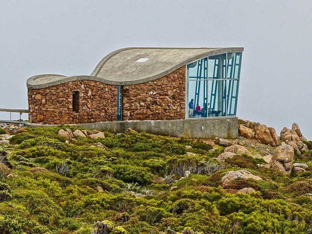
The trail continues to climb before descending to Lake Tahune hut, located near the shores of Lake Tahune. This hut is more modern than Lake Vera’s and includes sleeping platforms, a rainwater tank, and basic cooking facilities. Lake Tahune hut is the final overnight stop before the summit climb.
Day 3: Summit of Frenchmans Cap and return to Lake Vera hut (11km, 6–8 hours)
Day three begins with the climb to the summit of Frenchmans Cap. The trail rises steeply from Lake Tahune hut, with sections of loose rock and exposed ridgelines. Walkers should proceed with caution, particularly in wet or windy conditions.
The climb eventually levels out onto a plateau before the final push to the summit. At 1,446m, the summit of Frenchmans Cap offers panoramic views of the surrounding wilderness. On a clear day, walkers can see as far as Macquarie Harbour and the peaks of Tasmania’s southwest.
After taking in the views, walkers retrace their steps back to Lake Tahune hut. Following a short rest, the trail continues back to Lake Vera hut for the final night.
Day 4: Lake Vera hut to Trailhead (15 km, 5–7 hours)
The final day involves retracing the route from Lake Vera Hut back to the trailhead. Walkers descend through familiar terrain, including the Loddon Plains and the crossing of the Loddon River.
The return journey is often quicker than the outward walk, though muddy sections may still pose challenges. Upon reaching the car park, walkers can rest and reflect on the hike’s demanding but rewarding nature.
Practical details
The trailhead is on the Lyell Highway, approximately 55km west of Derwent Bridge and 200km northwest of Hobart. A small car park at the trailhead provides limited parking. There are no public transport options to the trailhead, so walkers need private vehicles or organised transfers.
Accommodation on the trail is in a choice of either camping or in huts at Lake Vera and Lake Tahune.
There are no toilets or water sources at the trailhead. Walkers should carry sufficient supplies for the hike. Rainwater tanks are located at the huts, although water should be boiled or treated before drinking.
No permits are required to hike the trail, but walkers must hold a Tasmanian National Parks Pass, available online or from visitor centres.
The Frenchmans Cap hike is physically demanding and requires careful preparation. The trail includes steep ascents, exposed sections and muddy plains. The hike requires a high level of fitness and experience with multi-day treks. Walkers should be confident carrying heavy packs across difficult terrain.
Track conditions vary depending on recent rainfall, with mud and slippery surfaces common year-round. Due to the wet and muddy conditions, waterproof boots and gaiters are essential with mud frequent on the Loddon Plains and wet conditions that can persist for days.
Tasmania’s southwest is known for unpredictable weather. Walkers should prepare for rain, strong winds, and low temperatures, even in summer.
Lyell Highway, Southwest TAS 7116
Website parks.tas.gov.au


